Upper Thailand anticipates a cold snap with chilly mornings and fog from November 17-23, 2025. Concurrently, southern Thailand faces heavy rains and flood risks, with rough seas in the Gulf.
Between 17 and 23 November 2025, an intense high-pressure system from China is expected to spread over northern, northeastern, central, and eastern parts of Thailand. This system will bring cooler temperatures and cold morning conditions predominantly to upper Thailand. Northeastern winds prevailing over these areas will reinforce the drop in temperature, particularly during morning hours where fog may develop in some locations. Residents are advised to prepare for the drop in temperature and take necessary precautions against morning chill and reduced visibility.
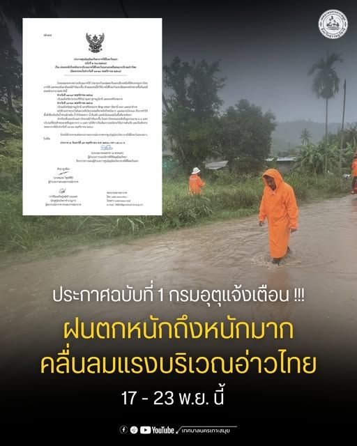
Rainfall and Thunderstorms in the South
Southern Thailand is forecasted to be affected by the strengthening northeast monsoon, resulting in moderate to heavy rainfall. Heavy to very heavy rain is likely across many provinces, particularly those on the eastern coast such as Nakhon Si Thammarat, Phatthalung, Songkhla, Pattani, Yala, and Narathiwat. These weather conditions could lead to an increased risk of flash floods and landslides, especially in low-lying and mountainous areas. Local authorities recommend continued monitoring of updates and exercising caution, especially near waterways.
Strong Winds and High Waves in the Gulf
The Gulf of Thailand will experience strong wind conditions throughout the forecast period. Wave heights are expected to reach 2-4 meters in most sea zones, with even higher waves during thunderstorms. Mariners and small boats are advised to remain ashore or operate with great caution. Coastal communities should beware of waves that may surge onto shorelines, particularly in exposed areas.
Precautionary Measures and Advisories
- In upper Thailand, the decrease in temperature necessitates appropriate clothing and preparedness for cold weather, particularly during the nighttime and early morning.
- Residents in the south and areas prone to flooding or landslides should stay alert to updates from local authorities and the Meteorological Department. Preparedness and early evacuation plans are recommended in high-risk areas.
- Mariners and coastal businesses should closely monitor marine forecasts, avoid unnecessary sea travel, and secure vessels due to rough sea conditions.
Implications for Transportation and Daily Activities
- Cold weather in the north and northeast may affect transportation, especially morning travel; extra caution is required for foggy conditions.
- Heavy rain in the south can disrupt road and rail transport due to floods and reduced visibility. Travelers should plan ahead and consider alternative routes.
- Fishing and shipping in affected Gulf areas could be delayed or suspended, impacting local livelihoods and supply chains.
Monitoring and Official Channels
Updates about weather conditions, warnings, and advisories are disseminated by the Meteorological Department through its official website, social media, and partner broadcast outlets. Residents and businesses are encouraged to stay informed and respond promptly to newly issued warnings.
Frequently Asked Questions
FAQ: Cold Weather and Weather Advisories in Thailand (Nov 17–23, 2025)
What should residents in upper Thailand expect during the cold snap from November 17-23, 2025?
Residents in northern, northeastern, central, and eastern parts of upper Thailand should anticipate cooler temperatures, cold mornings, and possible fog. Precautions such as wearing appropriate clothing and preparing for reduced morning visibility are advised.
How will the southern region of Thailand be affected by the forecasted weather?
Southern Thailand will experience moderate to heavy rainfall, particularly on the eastern coast, increasing the risk of flash floods and landslides. Residents in low-lying and mountainous areas should stay updated with local advisories and prepare for possible evacuations if necessary.
What precautions should mariners and coastal communities take due to strong winds and high waves in the Gulf of Thailand?
With wave heights reaching 2-4 meters and stronger during thunderstorms, mariners should avoid unnecessary sea travel, small boats should remain ashore, and coastal communities must beware of potential wave surges. Monitoring official marine forecasts is essential for safety.